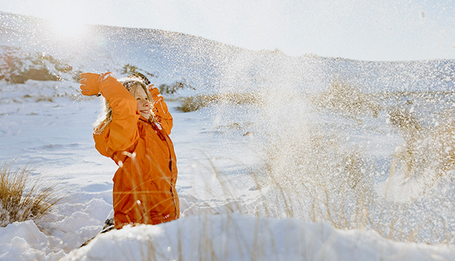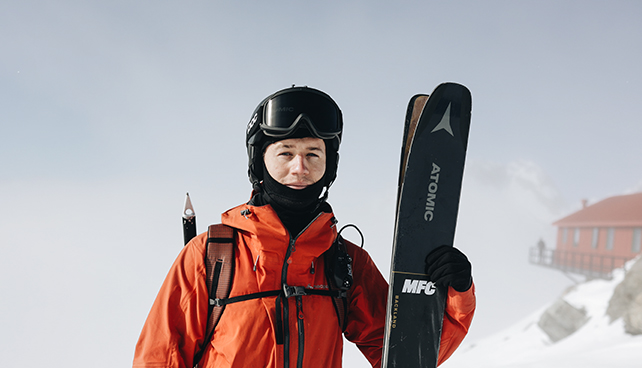
Discovering a new route is all fun and games until you have to carry packrafts, camp gear, skis, and seven days worth of food. Charlie Murray and two friends, Nick Pascoe & Jasper Gibson, spent 7 days in October 2023 travelling from Mt Aspiring National Park through to the West Coast.
Day 0 - Packing
After chatting about this potential route for a year with Nick, we were finally ready to pull the trigger. I think Nick had the idea running back and forth through his mind for the last three years. With a somewhat decent weather window approaching we cleared our schedules and locked it in. Throwing an assortment of gear into the back of the Subaru I made my way from Christchurch down to Wānaka.
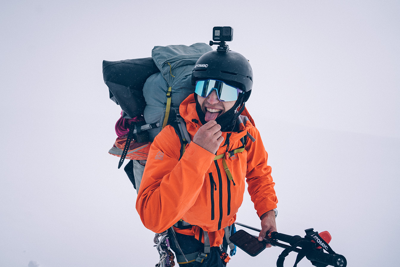
Arriving in the evening I went straight to Pascoe’s (Nick’s) place to chat and organise gear. His garage is HQ for his frequent crazy missions. Kayaks in various states of repair were strewn around the garage, along with numerous skis stacked against the wall. The main thing I was scanning for was two-pack rafts. Nick had his own and he’d borrowed one for me from the generous Blake Hornblow who originally was part of the crew for the mission. Unfortunately Blake couldn’t make it but that gave us the chance to substitute someone from the bench. With Pascoe in charge of the trip, it was his call who he wanted to add. He had done his homework and suggested Jasper Gibson, an experienced skier and general adventurer. It also was a bonus that Jasper is a professional photographer, someone keen to capture what we were going to attempt.
Day 1 - Raspberry Flat (West Matukituki) - French Ridge Hut
7am - We met at Pascoe’s and began loading the car. Three piles of gear in the driveway slowly grew in size. I started worrying, how on earth would we get all this stuff through 100kms of some of New Zealand's most rugged terrain? Once reality sunk in I started taking stuff out, spare underwear gone, winter sleeping bag gone, pack pillow gone, drysuit gone. Everywhere I could save space and weight I did, committing myself to 7 days in my ski outerwear. Pascoe and Jasper didn’t seem as worried about our huge amounts of gear. Although, reality hit Pascoe when had completely filled his 50L pack and still had half of his gear on the driveway.
We found Pascoe a 90L pack. Then crammed ski gear, ice gear, camp gear, pack rafts and 6 days of food in/on our packs and started the slow trudge from Raspberry Flat carpark up the valley. It was a treat to have Oliver and Amy take our packs in their ute for the first hour of gravel road. We were nervous about what lay ahead and when we shouldered our packs at Cascade hut. Our spirits were dampened slightly. These things weighed a ton.
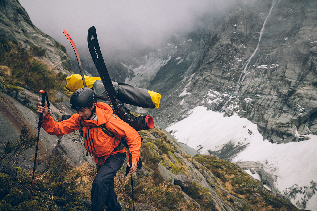
We quietly made our way up the valley. Arriving at the turn off to French Ridge Hut we agreed that we were too far behind schedule to safely make it to Colin Todd so opted to add another night onto the trip and head up to French Ridge. So, with plenty of grunting and sweating, we spent the entire afternoon climbing the steep track up to the hut. Our skis and packs would often get caught on overhead branches and someone above would have to unhook us or guide our ski tips away from snags.
Day 2 - French Ridge Hut - Colin Todd Hut
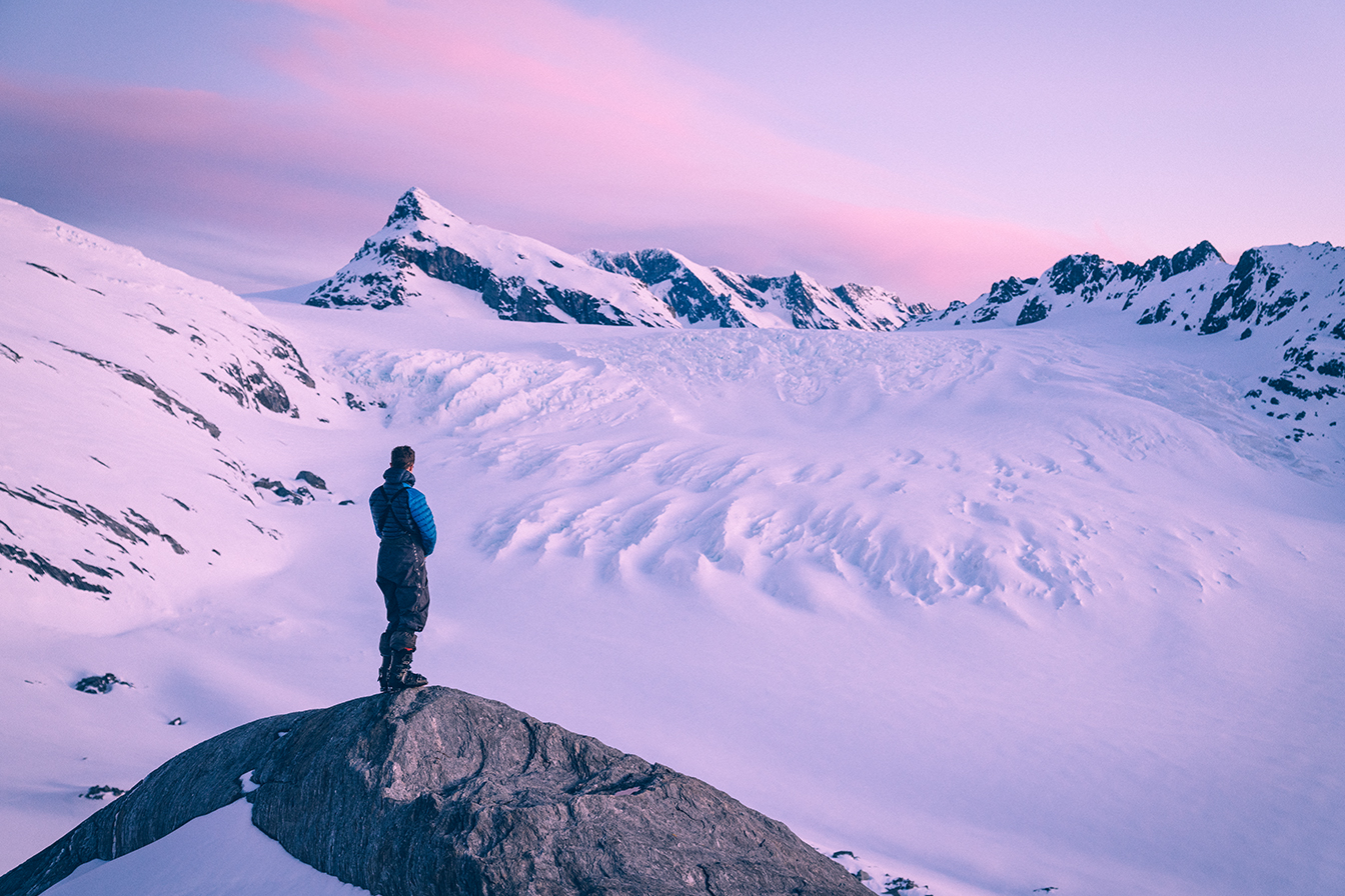
The second approach day. A fresh 10cm of southerly snow overnight made it a beautiful morning for a skin and boot up to Quarterdeck Pass. Our bodies were feeling a bit average underneath the heavy loads and we were already one day behind schedule so there was a little bit of apprehension in the crew. After a quick discussion we decided our window to attempt the crux was still open. So we skied down the Bonar glacier and punched out the short climb up to Colin Todd Hut. We arrived by early afternoon and began digging out the door of the hut which was under about 1.5m of snow.
We were treated to an incredible sunset and quickly befriended the climbing party of three that we were sharing the hut with. After a bleak weather forecast came through on the InReach we weren’t optimistic about getting over the crux the next day. Although we had limited food so decided we had to have a crack the following morning.
Day 3 - Storm - Stuck in Colin Todd
The first attempt to cross the main divide into the Waitoto catchment didn’t go to plan. We knew a storm was coming so we thought we’d make a 5am attempt to get to the river before it hit. The problem was the navigation across the Therma Glacier underneath Mt Aspiring was too dangerous to do at night, so we could only do the approach (as opposed to the approach & crossing) in darkness. We got to the Therma at first light and were met with strong winds and cloud, we waited for a few hours to see if the cloud would clear to get a visual of our route, but the conditions continued to deteriorate. After our window of action had closed the only option was to return to Colin Todd hut and wait out the storm. We only had 6 days of food and this storm and previous delay meant the 5-day trip had turned into a 7-day trip. Scavenger mode was engaged as we dug through a very limited communal food box in the hut. We found some nuts, seeds, a backcountry meal and a few biscuits. Our hut mates kindly gifted us some wraps which made a big difference to our future lunches.
The storm hit and we hunkered down in the hut. Gale force wind sandblasted snow against the side of the hut and going outside was an event in itself. We only ventured out when essential - to go to the toilet or collect snow for water. We lay in our sleeping bags reading hut books and trying not to think about food.
With an improving forecast and a dwindling food supply we decided that we either got to the Lower Volta the next day or we would have to turn around and head back to Wānaka defeated.
Day 4 - Colin Todd to 1086 Camp (Camp 1)
Well, this was the most hectic day I’d had for a while 😮💨
We started just before first light and booked it up to the Therma Glacier to find fine weather and moderate winds. Knowing this was our last chance it was now or never. We decided our cut off time would be at the ‘Prow’ (final ridge to access the Volta - (NZTM 1261012 5077437 2000m)) at 1pm. This meant we would still have enough time to get back to the hut if we had to turn around.
Traversing the Therma on the 2000m contour line, we assessed the condition of the shelf below the NE Ridge of Aspiring Tititea. The shelf looked manageable but we had high mist from the West Coast floating around 1800m. With a sheer cliff dropping 1000m somewhere below us, this was spooky. After a discussion, we scoped a line under the NE ridge to a ‘safe’ spot where we could see the access to the Prow. Skinning through large crevasses, we gained a flat spot on the Prow at about 2020m just in time for lunch.
Mist kept pushing in from the west at a height of 2000m making visibility difficult. After hefty deliberation, we all decided to continue. Using GPS we skied/sideslipped roped up. Very slowly we navigated down the Prow and managed to find the entry to the gully we thought was skiable down to the Lower Volta. Luckily the snow level was low enough and we could ski off the Prow into the glacial basin. As we dropped off the Prow the cloud cleared and we had the first remarkable view of the Lower Volta. It was confronting to see what used to be a massive 5km^2 sea of ice was now a soggy snow and gravel basin with a series of small lakes and the occasional house-size block of ice.
Reaching the remnants of the glacier the real challenge began. We traversed the soft moraine along the edge of the glacier but the recent melt meant the gravel and rock were unstable. After a few hundred metres took an hour, we reached a point where we couldn’t keep going. This was unmarked iceberg lake #1 (NZTM 1261845 5078984 1280m).
Loose gravel and boulder cliffs met icebergs with a watery thin, fragile ice crust. We were forced to inflate a raft and sent Pascoe to attempt a crossing. We didn’t trust the thin layer of ice so we roped him up and held the other end. Sure enough, when he stepped onto an ice floe it cracked and he fell through into the lake (he had his PFD on). Eventually he found a route through the ice once back on the raft.
Once a route had been cleared, we ferried all three of us, our skis and gear across. We then repacked the rafts and scrambled down to unmarked iceberg lake #2. It was slow going but luckily we found a route down one of the youngest river valleys in NZ. On the topo map we were underneath approximately 100m of glacial ice but in reality, it was a jumble of huge boulders and a steep creek exposing the bedrock.
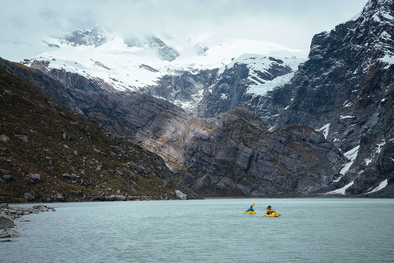
Upon reaching unmarked iceberg lake #2 (NZTM 1260405 5079272 1000m) we inflated the boats. Earlier we witnessed major icefall from Therma glacier which landed in the lake in front of us - due to this overhead hazard we moved as quickly as possible, staying on the opposite side of the lake. Unfortunately, the wind had blown all the icebergs up against our side so we had to push a route through the ice. As quick as we could we paddled to the outlet, pulled up on the true right and ran to a safe area to repack.
Darkness was pressing, and with only steep, glacier-worn bedrock around, we donned head torches and travelled to find a safer location. Thankfully, shortly after we stumbled across a wide gully with a spot suitable for camp. We moved some rocks, smashed some food and crawled into bed exhausted.
Day 5 - 1086 Camp to Lonesome Creek Camp
After a loud night of icefall, we woke to a cool morning with wisps of cloud. The North face of Tititea was visible 2000m above as was the route we skied 24hrs earlier. We felt like we were in a cathedral, the ice had carved a cirque in the rock and cliffs rose vertically 1000m on all sides.
Pulling down camp and reloading the packs we set off, traversing a network of ledges and glacial bedrock down towards the Waitoto source lake. After a few hours of route finding and clambering over large rock features, we found ourselves on a shelf 200m above the lake. Our homework came in handy as we cross-referenced our location with the route of a previous trip that came from the west. Heading down an unlikely-looking gully filled with house-sized boulders, we expected to set up an abseil point but managed to scramble without. Reaching the source lake we finally relaxed, breathing a sigh of relief. It felt good to have the unknowns of the Lower Volta behind us. Now we only had one worry, our dwindling food supply.
After a quick lunch we inflated the rafts and started the 2km headwind paddle to the start of the Waitoto river. Reaching the lake end we transitioned back to foot as there was a gorge downstream that could be impassible. We travelled down the true left of the river before bush bashing 500m for two hours to the Splasher Creek. The bush, thick in places, required us to remove our gear and pass them forward. Deciding anything was better than the bush, we descended the Splasher which required one small 5m rappel before we hit the Waitoto gorge. Here we found the next challenge, the gorge was impassible on the true left so we had to cross the steep tumbling rapids. It was too dangerous to cross on foot even with a rope for security so we had to inflate two boats again and used them to ferry gear and people across the swift current. Safely on the true right we scrambled downstream for another few hours until it got dark. We set up camp opposite Lonesome Creek, cooked some food and crawled into our sleeping bags relieved that the crux of the trip was behind us.
Day 6 - Lonesome Creek to Caseys Flats
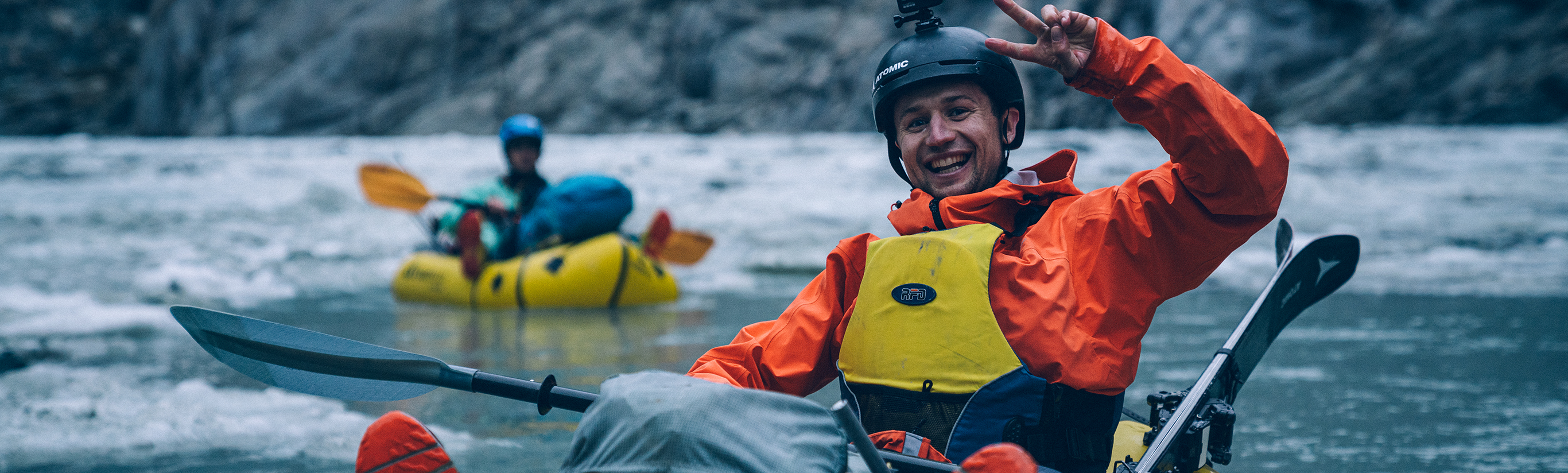
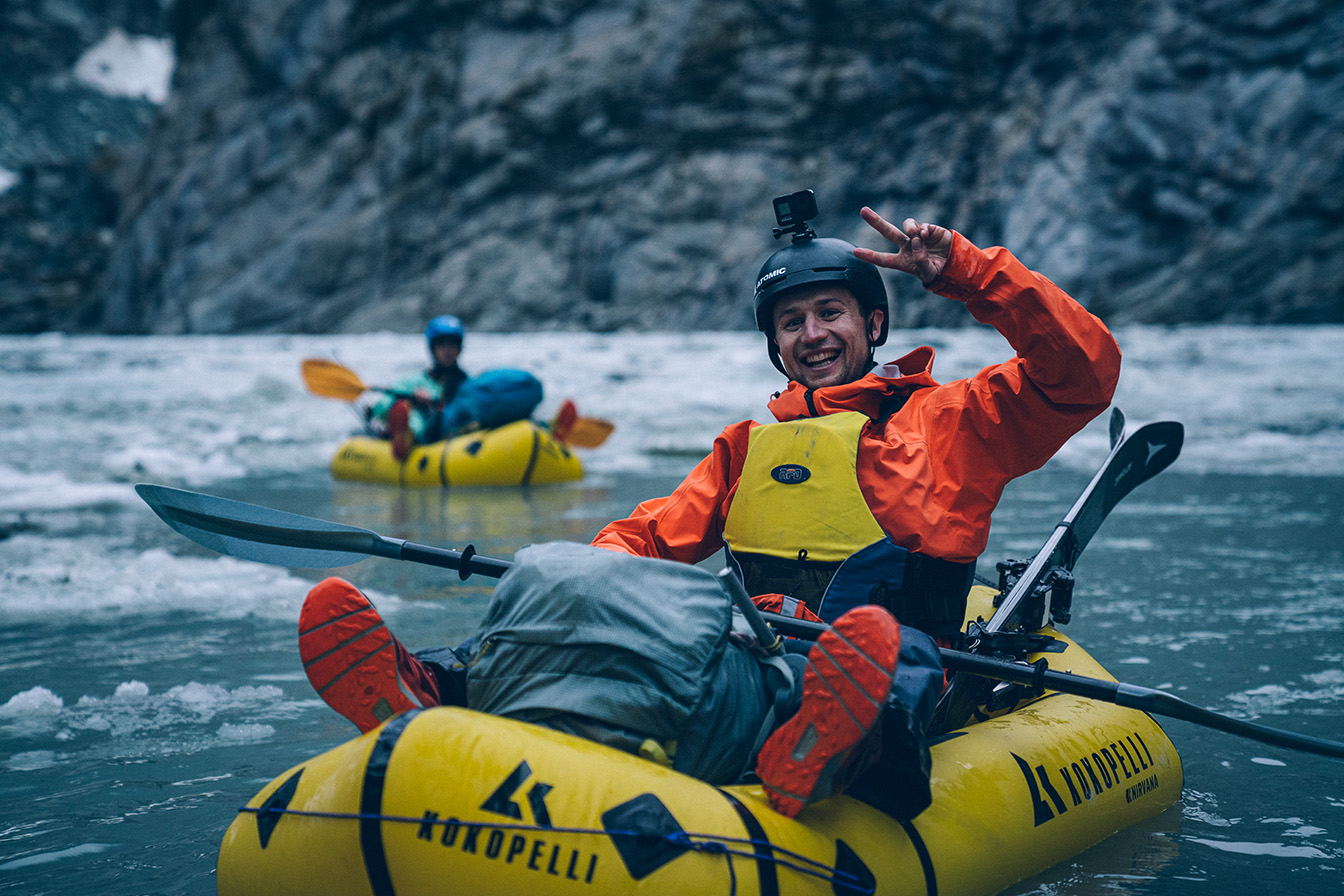
Finally, we could use our rafts for their actual purpose! We woke at first light, packed up and strolled for 10mins down the riverbed to a place suitable to launch the boats. Unfortunately, half of Jaspers paddle had been stolen by the bush the previous day but luckily, the ever-positive Nick Pascoe said he’d be happy to Paddle C1 (one blade only) as he’d had plenty of practice over the years.
We inflated the rafts and rigged the skis. We had to be careful that all our sharps and edges were either taped up or wrapped in prusik cord. Finally, we hit the river! It felt incredible to be floating and paddling instead of trudging along underneath a heavy pack.
We paddled about 11km downstream to the bottom of the Drake Flats. We then decided to portage as the rapids in the gorge below looked too sporty for heavy boats with skis strapped to the sides. After a few hours bashing through incredible West Coast rainforest, we found a place to rejoin the river. At this point, our 6-day food supplies were on their last legs. Luckily Pascoe had the foresight to pack a little extra food. Combined with the Colin Todd hut food we knew we could stretch it for at least another day.
Back on the river we made good time with the occasional stop to scope or portage a rapid if it looked too big. Towards dusk we reached the Axius flats and the river became smooth with electric blue water flowing against lush forest. Arriving at Caseys Flats at dusk we pulled up the boats and stopped for the night, satisfied but exhausted.
Day 7 - Caseys Flats to West Coast (Jackson’s Bay)
The final day. During the trip we were able to communicate with my partner, Harriet, for weather updates and Adie, to organise a pick-up at Jackson bay. This was a game changer, it helped us to make the right decisions when push came to shove.
We knew that a westerly weather bomb was coming so we were happy to be sneaking out before the rivers flooded. Hungry, and with rain that got progressively worse, we made our way through a beautiful gorge and around a big rapid. After 5km we realised we’d left the InReach back at camp. I elected to go back for it so I stripped down and in nothing but a rain jacket and underwear, I ran up the route from Palmer Creek back to Caseys Flat. It took about an hour each way, a few times I lost the track and had to run around the jungle until I found it again.
Meanwhile, the boys were shivering on the side of the river trying not to eat the last handful of nuts and last muesli bar. Returning successfully with the beacon almost two hours later we finished the remaining scraps of food and got back on the river.
Pascoe only had half a paddle so the flat water was hard work for him. We rigged a tow line and Jasper towed him. My boat was slowly losing air so when I would stop to pump it up the others would keep towing and we ended up traveling at about the same speed.
As we got closer to the coast we started to find people fishing on the side of the river who couldn’t figure out what on earth we were doing. When we explained our trip to one man he simply replied “ah, you bloody idiots”. We cracked up laughing. Not a bad way to be reintroduced to the real world.
Eventually, we reached the West Coast ocean and found Adie patiently waiting with lots of food. We were soaking wet, exhausted and hungry but stoked with what we’d accomplished.
A massive thank you to the boys Nick Pascoe and Jasper Gibson for being such a solid team, everyone played to their strengths, managed our weaknesses and we got outside of our comfort zones. Thank you to Neil Sloan for some pre-trip intel and FMC for backing us in this adventure.